
Planet’s Dove smallsats.
Image is courtesy of the company.
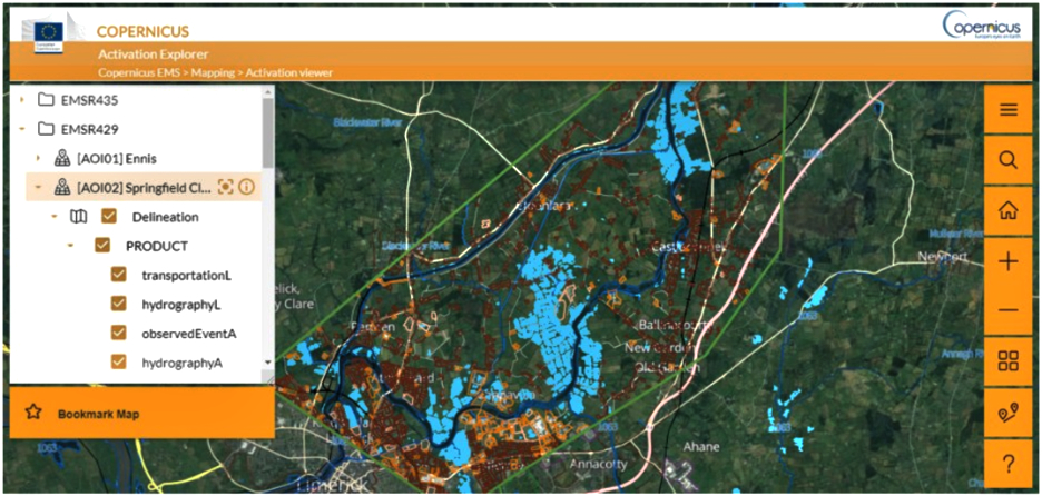
The Copernicus Emergency Management Service, or Copernicus EMS, uses Planet data to help provide emergency response mapping services for a variety of disaster situations, ranging from geophysical and meteorological hazards to humanitarian and man-made crises.
When events occur, authorized users can alert Copernicus EMS to an emergency location, and the service provides satellite-derived products for quick and effective response. It also provides information that can aid in disaster preparedness, prevention and recovery.
Copernicus EMS is managed by the European Commission and operated by the Joint Research Centre of the European Commission. The European Space Agency (ESA) is responsible for providing satellite data for the requested products, both from Sentinel missions and from commercial data providers. Planet and ESA entered into an agreement allowing ESA to access both PlanetScope and SkySat as one of the Copernicus Contributing Missions—with the aim of combining Planet data with information gleaned from Sentinel satellites.
As Copernicus EMS has access to Planet’s SkySat constellation—which will have increased rapid revisit capabilities due to the upcoming launch of more SkySats—the service is able to provide governments and other organizations with critical geospatial information within hours or days of a disaster, charting changes in near-real time. With access to Planet’s extensive PlanetScope and SkySat imagery archive, Copernicus EMS is also able to supply organizations with imagery of a location before an event occurs. This allows the service to provide risk and recovery maps and an early warning and monitoring component, which includes support in case of droughts, wildfires and floods.
The service connects decision-makers with the critical geoinformation they need, empowering them to assess situations with more clarity and make educated decisions.