RBC Signals and SatRevolution Agree on Ground Services for CubeSat Missions

An agreement between RBC Signals in Seattle, Washington, a provider of flexible and cost-effective space communication services, and SatRevolution, a forerunner of new space industry in Poland, today announced they have signed an agreement. The contract secures Telemetry Tracking and Command (TT&C) and data downloads for SatRevolution, supporting a group of the new space company’s cubesats slated for launch in December 2020. 

Christopher Richins, CEO of RBC Signals said that the RBC Signals team is proud to support SatRevolution’s cubesats with their global space communications network. Their infrastructure is uniquely suited to support operators like SatRevolution with resilient, flexible and cost-effective services that reliably meet their mission needs.

The SatRevolution satellites include dedicated and shared in-orbit demonstration platforms for SatRevolution customers. RBC Signals will provide data delivery services for the spacecraft via the company’s global ground station network. The network is comprised of over 70 antennas in over 50 strategic locations across the globe. SatRevolution will be able to schedule access to ground stations seamlessly through ROSS, RBC Signal’s intuitive online interface for requesting antenna time.

Grzegorz Zwolinski, co-founder and COO of SatRevolution concluded that they’re happy to begin their cooperation with RBC Signals. At SatRevolution, they believe the ‘ground station as-a-service’ approach is a very scalable and cost-effective way to manage ground services for multiple satellites.

The agreement between SatRevolution and RBC Signals spans multiple missions with the option for continued services thereafter.


Tethers Unlimited to Participate in NASA’s PUNCH Mission


SWIFT-UTX UHF-Band Communications Transmitter (l),
HYDRO S-C™ (r).

Tethers Unlimited, Inc. (TUI) has announced the company has been contracted to provide key communications and propulsion capabilities to Southwest Research Institute (SwRI) in support of the NASA PUNCH Mission.

TUI will be delivering flight units of both its SWIFT®-XTS X-band software defined radio (SDR) and its HYDROS™-C water-electrolysis thruster.

The PUNCH mission will consist of a constellation of four smallsats that will launch as early as 2022 and they will orbit the Earth in formation to study how the Sun’s atmosphere, or corona, connects with the interplanetary medium. PUNCH will provide the first global images of how the solar corona infuses the solar wind with mass and energy.


A constant outflow of solar material streams out from the Sun, depicted here in an artist’s rendering. On June 20, 2019, NASA selected two new missions – the Polarimeter to Unify the Corona and Heliosphere (PUNCH) mission and Tandem Reconnection and Cusp Electrodynamics Reconnaissance Satellites (TRACERS) – to study the origins of this solar wind and how it affects Earth. Together, the missions support NASA’s mandate to protect astronauts and technology in space from such radiation.
Image credit: NASA

The SWIFT-XTS radio will be used for telemetry and control as well as main mission data downlink. The SWIFT-XTS radio is a compact and affordable S-band transceiver coupled with a high-speed X-band transmitter.  Its “software defined” attributes make it readily configurable to support a wide range of mission needs, including in-flight adjustment of operating frequencies and modulations. The SWIFT software defined radios enable satellite operators to rapidly configure and tune their communications systems to maximize the amount of data they can deliver through the congested radio frequency spectrum.

TUI will also be providing an 8W X-band RF power amplifier for this program to enable the satellites to reliably close the communications link to ground stations from their distant orbits. The company’s SWIFT-XTS Software Defined Radio supports both reliable telemetry, tracking, and control (TT&C) and high-speed mission data delivery for small satellite missions.

The HYDROS-C is a shoebox-sized propulsion module that uses water as propellant. Unlike other water-based thrusters that simply expel heated steam, TUI’s HYDROS-C module first uses electrolysis to split water into its constituent elements, hydrogen and oxygen. The HYDROS-C module then burns the hydrogen and oxygen in a traditional bipropellant thruster. This water electrolysis method enables HYDROS to deliver better thrust efficiency than existing electric propulsion options and provides higher fuel economy than chemical thrusters. By using water, HYDROS-C is a truly “green propellant” solution that is safe for personnel during satellite integration as well as for primary payloads during launch. The availability of water on the moon and near-Earth asteroids makes HYDROS-C appealing as a refuellable propulsion option for future exploration architectures.

SwRI’s Dr. Craig DeForest, the PUNCH mission Principal Investigator, noted that procuring these complete spacecraft subsystems “off-the-rack” is critical to the PUNCH science. The growing commercial ecosystem for space enables a constellation of four, separate, high-capability spacecraft, within the cost of a single traditionally-built satellite.

Dr. Rob Hoyt, TUI’s President, said understanding how the sun drives the solar wind is critical to understanding how the sun influences space weather near the Earth as well as the fundamental processes that create solar systems. Tethers Unlimited will contribute the firm’s unique communications and propulsion technologies to enable these tiny spacecraft to accomplish such an important scientific mission.


Image is courtesy of NASA JPL.


Planet Illustrates Their New 50 cm SkySat Imagery, Tasking Dashboard and Up to 12x Revisit


The Old City of Tripoli, Libya imaged at 50 centimeters per pixel from an altitude of 456 kilometers. © 2020, Planet Labs Inc.
All Rights Reserved.

Over the past year, Planet has seen increased demand for its SkySat imagery to fulfill customers’ needs for timely, accurate and frequent information across the decision cycle — the COVID-19 pandemic has intensified this trend, as traditional surveying and inspection methods are not currently possible.

To meet the present moment, and demonstrate the company’s commitment to rapidly deliver more value to customers every year, Planet has unveiled three new releases as part of their overall tasking offerings. Combined, these releases enhance the core imagery for analysis as well as reduce friction to acquire that data.

Higher Resolution
50 cm imagery: In just six months, we successfully lowered our SkySat constellation to enhance the spatial resolution of our SkySat imagery from 80 to 50 cm for our ortho product. This improvement enables customers to get a more precise view of changing conditions on the ground and adds more granular context to decision-making. This is particularly important for commercial and government mapping use cases, where seeing smaller features like road surface markings are key.


50 cm SkySat imagery of the Mundra Power Plant in Gujarat, India, on April 4, 2020. © 2020, Planet Labs Inc.
All Rights Reserved.

Tasking Dashboard
Planet’s imaging pipeline and delivery infrastructure have been built in the cloud and the Tasking Dashboard and API are the latest results of that foundation. The Tasking Dashboard is a new user interface that allows customers to request SkySat collections, while our new API provides efficient, automated access. Instead of spending precious time going back and forth with a human rep, with the Tasking Dashboard and API, customers can autonomously submit, modify and cancel SkySat imagery requests. This enables visibility into the end-to-end experience, from order to fulfillment, so expectations can be managed with analysts and teams.


Screenshot of Planet’s Tasking Dashboard © 2020, Planet Labs Inc.
All Rights Reserved.

Rapid Revisit, with up to 12x revisit capabilities
Planet guarantees sub-daily revisit and the upcoming launch of six new SkySats will allow the company to image certain locations up to 12 times per day, at a global average of 7 times per day. This unprecedented capability will provide more rapid response to global events and enable imaging at times of the day previously unseen by satellites.

At Planet’s SkySat offerings support the company’s growing customer base, from federal and civil governments, to commercial forestry to energy and more. These product advances are key components of Planet’s overall mission to democratize access to satellite imagery, providing critical intelligence to customers and organizations when they need it most.


The first SkySat image (taken in the morning) and second SkySat image (taken in the afternoon) were collected on May 20, 2020, and show the remains of the Edenville Dam, breached after heavy rainfall over Michigan. The silvery appearance of the water in the morning is due to sunglint, which is the reflection of light directly into the satellite’s telescope. © 2020, Planet Labs Inc.
All Rights Reserved.

Story by Martin Van Ryswyk, the Senior Vice President of Product at Planet

Rocket Lab’s Launch ‘Don’t Stop Me Now’ Set to Take Off … Finally

A launch delay, through no fault of their own caused by the COVID-19 virus, is finally back on schedule for Rocket Lab’s 12th Electron launch, the ‘Don’t Stop Me Now’ mission from Launch Complex 1. Originally slated to launch in late March the mission will lift payloads for the National Aeronautics and Space Administration (NASA), the National Reconnaissance Office (NRO) and the University of New South Wales (UNSW) Canberra Space. The mission has been named ‘Don’t Stop Me Now’ in recognition of Rocket Lab board member and avid Queen fan Scott Smith, who recently passed away.

‘Don’t Stop Me Now’ is a rideshare mission that will launch several small satellites, including the ANDESITE (Ad-Hoc Network Demonstration for Extended Satellite-Based Inquiry and Other Team Endeavors) satellite created by electrical and mechanical engineering students and professors at Boston University. The satellite will launch as part of NASA’s CubeSat Launch Initiative (CSLI) and will conduct groundbreaking scientific study into Earth’s magnetic field.

Once in space, the ANDESITE satellite will initiate measurements of the magnetosphere with onboard sensors, later releasing eight pico satellites carrying small magnetometer sensors to track electric currents flowing in and out of the atmosphere, a phenomenon also known as space weather. These variations in the electrical activity racing through space can have a big impact on our lives here on Earth, causing interruptions to things like radio communications and electrical systems. The ANDESITE satellite follows on from Rocket Lab’s first ELaNa (Educational Launch of Nanosatellites) launch for NASA, the ELaNa-19 mission, which launched a host of educational satellites to orbit on Electron in December 2018.

Launch Window: 

Rocket Lab is currently targeting no earlier than 04:43, June 11, UTC for lift-off. 

Time zones:

UTC: 11 June (04:43 – 06:32)

NZT: 11 June (16:43 – 18:32)

ET: 11 June (00:43 – 02:32)

PT: 10 June (21:43 – 23:32)

Rocket Lab has backup opportunities available through June 24th.

The mission also carries three payloads designed, built and operated by the NRO. The mission was procured under the agency’s Rapid Acquisition of a Small Rocket (RASR) contract vehicle. RASR allows the NRO to explore new launch opportunities that provide a streamlined, commercial approach for getting small satellites into space, as well as provide those working in the small satellite community with timely and cost-effective access to space. This mission follows Rocket Lab’s first dedicated mission for the NRO, Birds of a Feather, which was launched on January 312020 NZT from Rocket Lab Launch Complex 1.

The ANDESITE and NRO payloads will be joined on the mission by the M2 Pathfinder satellite, a collaboration between the University of New South Wales (UNSW) Canberra Space and the Australian Government. The M2 Pathfinder will test communications architecture and other technologies that will assist in informing the future space capabilities of Australia. The satellite will demonstrate the ability of an onboard software-based radio to operate and reconfigure while in orbit. Rocket Lab will not be carrying out any recovery testing on the Electron launch vehicle during this mission.


Chinese Auto Manufacturer Entering the Smallsat Build Business

Last month, Zhejiang Geely Holding Group Co., known as Geely Holding Group, announced the company has begun construction on an intelligent satellite production and testing center, thereby making the firm the first private carmaker to produce satellites in China.

The new facility is being built by Geely Holding Group’s subsidiary, Geely Technology Group, in Taizhou, east China’s Zhejiang province.

The facility will include a modular satellite manufacturing center, a satellite testing center, a satellite R&D center and a cloud computing center and will be able to develop and produce a variety of different satellite models. The satellite strategy will be implemented by Geespace, a Geely-run company established in 2018 for the development, launch and operation of low-orbit satellites.

By the end of 2020, Geespace will begin the launch of its commercial low-orbit satellite network that will facilitate highly accurate navigation for self-driving cars.

Li Shufu, the Chairman of Geely Holding Group, said that the automotive industry faces huge challenges and equally huge opportunities. Geely must take the initiative to embrace change, develop through innovation, find new synergies online and offline, and cooperate with global partners to become a global technology leader, drive change in mobility, and create new value for users. He added that Geely’s entry into the field of satellites is part of its transformation into a global mobility technology group.

A company spokesperson stated that the firm’s expansion into low-orbit satellites marks a significant milestone in the creation of a truly smart three-dimensional mobility ecosystem. Low-orbit satellites will be able to offer high-speed internet connectivity, highly precise navigation and cloud computing capabilities.

Axelspace and Japan Space Systems Sign MoU to Promo Use of Satellite Data


The Suez Canal, Egypt.
Image capture by Axelspace.

Axelspace Corporation has signed a memorandum of understanding with Japan Space Systems (“J-spacesystems”) to promote the use of satellite data in the field of capacity building and human resource development.

Since 2012, J-spacesystems has engaged in capacity building programs in order to contribute to SDGs and address global social issues through the use of satellite data. To date, these programs have reached over 100 individuals in 30 countries around the world. In the past these programs have sought to reduce costs by using freely available satellite imagery, which does not always offer satisfactory imaging frequency or resolution for analysis. Furthermore, imagery of more specific locations and observation requests are unavailable.

AxelGlobe is Axelspace’s next generation Earth observation (EO) platform that will offer convenient access to imaging data at the resolution of 2.5 meters – a level which is rarely seen in freely available data. With four launches planned in 2020, the AxelGlobe constellation will soon comprise five satellites and offer the ability to image any location on Earth once every three days. By 2022, we plan to further expand the constellation to offer updated imaging on a daily basis.


Artistic rendition of an Axelspace smallsat. Image is courtesy of the company.

Through this partnership, Axelspace and J-spacesystems will use AxelGlobe data to meet the high resolution and high frequency needs of the aforementioned capacity building programs (including support for programs such as the Japanese Government’s ABE Initiative*1), as well as promote the broader use of such data to address issues raised by program participants. In doing so, our companies hope to make a substantial contribution to achieving SDGs.

*1 ABE Initiative At the 5th Tokyo International Conference on African Development (TICAD V) in June 2013, Japan unveiled a public-private partnership program to support stable and sustainable economic development in Africa. In his keynote speech, Prime Minister Abe announced the Africa Business Education Initiative for Youth (“ABE Initiative”), a five-year program offering 1,000 young people in Africa opportunities to pursue undergraduate and graduate education at Japanese universities, as well as internships at Japanese companies. As highlighted in the “Proposal by the Public-Private Council for the Promotion of TICAD V”, this initiative seeks to support human resource development in both the private and public sectors of Africa, deepen awareness of Japanese technology and companies among African nations, and increase the number of Africans visiting Japan. Additionally, the “ABE Initiative 3.0” was announced at TICAD VII as a six-year program with the goal of training 3,000 individuals. For further details please refer to the following website:

www.jica.go.jp/english/countries/africa/internship.html

www.jica.go.jp/africahiroba/business/detail/03/ku57pq00001jwm0b-att/abc_pamphlet_en.pdf


Momentus to Support the Taiwanese IRIS-A Mission with NCKU and ODYSSEUS Space

Momentus recently signed a launch service agreement with NCKU Space Laboratory and ODYSSEUS Space.

The company is supporting the IRIS-A mission, which is of strategic importance to Taiwan and is the first of three satellite launches, with follow up missions IRIS-B and IRIS-C due to reach space in 2022 and 2023. IRIS-A will be equipped with Internet of Things (IoT) technologies to achieve a Doppler shift estimation and improve the quality of downlink signal, increasing the efficiency of future IoT constellations of smallsats intended to monitor objects from space.

ODYSSEUS is a young startup based in Taiwan created by French professionals coming from the European space sector. They have experience and expertise both in Asia and in Europe to uniquely address the booming global market of small satellites applications.

ODYSSEUS has been working with National Cheng Kung University (NCKU) of Tainan, Taiwan, for many years now. IoT is a hot topic in Taiwan and Momentus is delighted to be working with leaders in the sector to bring the technology to space.

The Momentus Vigoride solution is highly innovative and provides smallsat developers, such as NCKU and ODYSSEUS, with long awaited flexibility in the choice of their orbit and their timeline.


National Cheng Kung University (NCKU) of Tainan, Taiwan, team.


JPL’s CubeSat’s Small Footprint Accomplishes a Big Feat


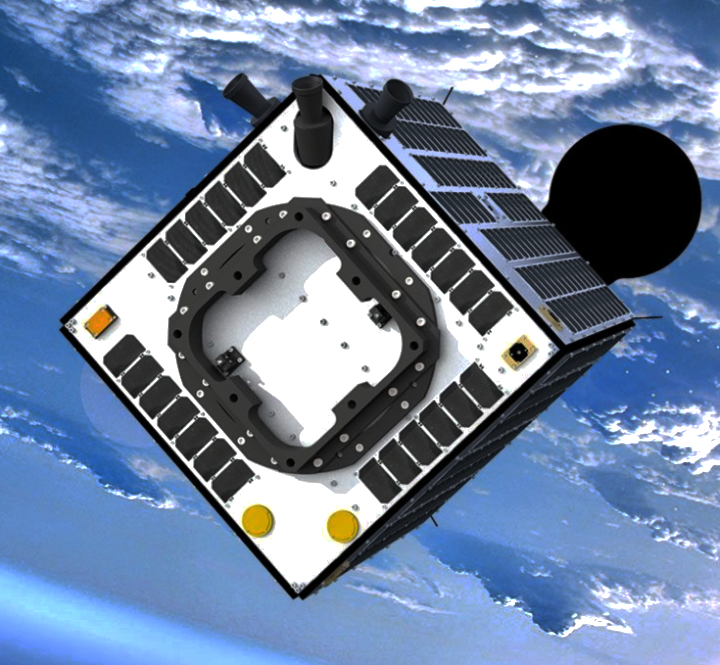
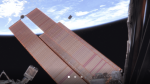
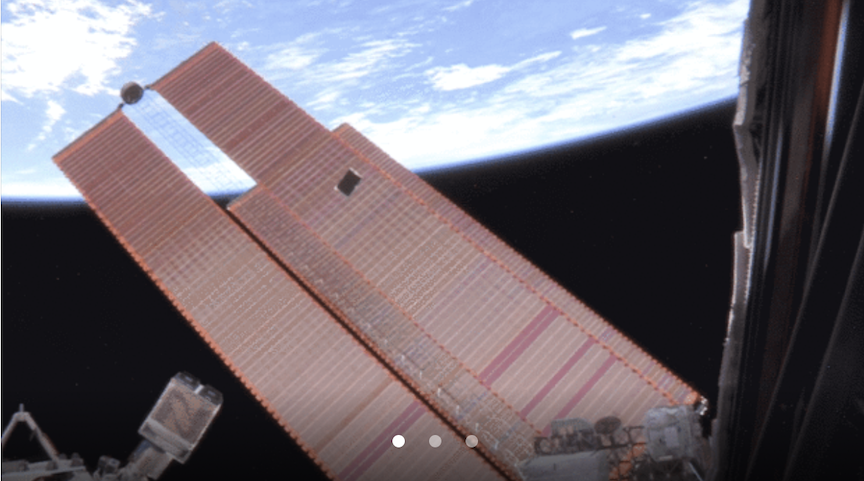
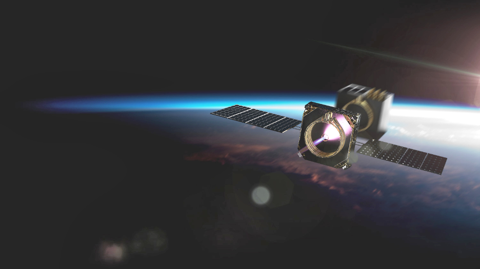
ASTERIA was deployed from the International Space Station on
November 20, 2017. Credit: NASA/JPL-Caltech


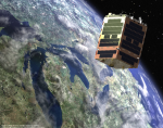
Long before it was deployed into low-Earth orbit from the International Space Station in Nov. 2017, the tiny ASTERIA spacecraft had a big goal: to prove that a satellite roughly the size of a briefcase could perform some of the complex tasks much larger space observatories use to study exoplanets, or planets outside our solar system. A new paper soon to be published in the Astronomical Journal describes how ASTERIA (short for Arcsecond Space Telescope Enabling Research in Astrophysics) didn’t just demonstrate it could perform those tasks but went above and beyond, detecting the known exoplanet 55 Cancri e.

Scorching hot and about twice the size of Earth, 55 Cancri e orbits extremely close to its Sun-like parent star. Scientists already knew the planet’s location; looking for it was a way to test ASTERIA’s capabilities. The tiny spacecraft wasn’t initially designed to perform science; rather, as a technology demonstration, the mission’s goal was to develop new capabilities for future missions. The team’s technological leap was to build a small spacecraft that could conduct fine pointing control — essentially the ability to stay very steadily focused on an object for long periods. 

Based at NASA’s Jet Propulsion Laboratory in Southern California and at the Massachusetts Institute of Technology, the mission team engineered new instruments and hardware, pushing past existing technological barriers to create their payload. Then they had to test their prototype in space. Though its prime mission was only 90 days, ASTERIA received three mission extensions before the team lost contact with it last December. 

The CubeSat used fine pointing control to detect 55 Cancri e via the transit method, in which scientists look for dips in the brightness of a star caused by a passing planet. When making exoplanet detections this way, a spacecraft’s own movements or vibrations can produce jiggles in the data that could be misinterpreted as changes in the star’s brightness. The spacecraft needs to stay steady and keep the star centered in its field of view. This allows scientists to accurately measure the star’s brightness and identify the tiny changes that indicate the planet has passed in front of it, blocking some of its light. 

ASTERIA follows in the footsteps of a small satellite flown by the Canadian Space Agency called MOST (Microvariability and Oscillations of Stars), which in 2011 performed the first transit detection of 55 Cancri e. MOST was about six times the volume of ASTERIA – still incredibly small for an astrophysics satellite. Equipped with a 5.9-inch (15-centimeter) telescope, MOST was also capable of collecting six times as much light as ASTERIA, which carried 2.4-inch (6-centimeter) telescope. Because 55 Cancri e blocks out only 0.04 percent of its host star’s light, it was an especially challenging target for ASTERIA. 

“Detecting this exoplanet is exciting, because it shows how these new technologies come together in a real application,” said Vanessa Bailey, the principal investigator for ASTERIA’s exoplanet science team at JPL. “The fact that ASTERIA lasted more than 20 months beyond its prime mission, giving us valuable extra time to do science, highlights the great engineering that was done at JPL and MIT.” 

Big Feat

The mission made what’s known as a marginal detection, meaning the data from the transit would not, on its own, have convinced scientists that the planet existed. (Faint signals that look similar to a planet transit can be caused by other phenomena, so scientists have a high standard for declaring a planet detection.) But by comparing the CubeSat’s data with previous observations of the planet, the team confirmed that they were indeed seeing 55 Cancri e. As a tech demo, ASTERIA also didn’t undergo the typical prelaunch preparations for a science mission, which meant the team had to do additional work to ensure the accuracy of their detection.

“We went after a hard target with a small telescope that was not even optimized to make science detections – and we got it, even if just barely,” said Mary Knapp, the ASTERIA project scientist at MIT’s Haystack Observatory and lead author of the study. “I think this paper validates the concept that motivated the ASTERIA mission: that small spacecraft can contribute something to astrophysics and astronomy.”

While it would be impossible to pack all the capabilities of a larger exoplanet-hunting spacecraft like NASA’s Transiting Exoplanet Survey Satellite (TESS) into a CubeSat, the ASTERIA team envisions these petite packages playing a supporting role for them. Small satellites, with fewer demands on their time, could be used to monitor a star for long periods in hopes of detecting an undiscovered planet. Or, after a large observatory discovers a planet transiting its star, a small satellite could watch for subsequent transits, freeing up the larger telescope to do work smaller satellites can’t. 

Astrophysicist Sara Seager, principal investigator for ASTERIA at MIT, was recently awarded a NASA Astrophysics Science SmallSat Studies grant to develop a mission concept for a follow-on to ASTERIA. The proposal describes a constellation of six satellites about twice as big as ASTERIA that would search for exoplanets similar in size to Earth around nearby Sun-like stars. 

Thinking Small 

To build the smallest planet-hunting satellite in history, the ASTERIA wasn’t simply shrinking hardware used on larger spacecraft. In many cases, they had to take a more innovative approach. For example, the MOST satellite used a camera with a charge-coupled device (CCD) detector, which is common for space satellites; ASTERIA, on the other hand, was equipped with a complementary metal-oxide-semiconductor (CMOS) detector — a well-established technology typically used for making precision measurements of brightness in infrared light, not visible light. ASTERIA’s CMOS-based, visible-light camera provided multiple advantages over a CCD. One big one: It helped keep ASTERIA small because it operated at room temperature, eliminating the need for the large cooling system that a cold-operating CCD would require. 

“This mission has mostly been about learning,” said Akshata Krishnamurthy, co-investigator and science data analysis co-lead for ASTERIA at JPL. “We’ve discovered so many things that future small satellites will be able to do better because we demonstrated the technology and capabilities first. I think we’ve opened doors.” 

ASTERIA was developed under JPL’s Phaeton program, which provided early-career hires, under the guidance of experienced mentors, with the challenges of a flight project. ASTERIA is a collaboration with MIT in Cambridge; MIT’s Sara Seager is principal investigator on the project. Brice Demory of the University of Bern also contributed to the new study. The project’s extended missions were partially funded by the Heising-Simons Foundation. JPL is a division of Caltech in Pasadena, California.

Momentus and OrbAstro Ink a Launch Contract

Momentus and OrbAstro have announced a launch contract to fly a 3U smallsat to SSO onboard the SpaceX Dedicated rideshare mission in 2021.

This on-orbit demonstration mission on a 3U OrbAstro platform will host a variety of payloads:

  • An Ultrascale+ based onboard computer, 10X more powerful than the current state-of-the-art in Zynq 7030 based systems, coupled to an Artificial Neural Network based constellation management system
  • An Electrical Power System with a novel battery chemistry, allowing typically a 5X increase in mission lifetime compared to conventional Li-ion chemistries for a given volume and mass
  • A compact ADCS allowing for fast steering and accurate pointing, tailored for precision formation-flight A new type of thermal management system, allowing kW-class payloads to operate on smallsat-class platforms at a compelling duty cycle


Smallsat flocking is relevant to existing and emerging markets in newspace. OrbAstro believes there is much needed room for improvement in constellation-level efficiency, so the new company is developing the onboard hardware and software to close the gap. The company is focused on launching its own flocks as well as innovating in hardware and software for space.

Dr. Ash Dove-Jay, Founder and CEO, OrbAstro, said allowing this IOD, the company expects to launch a small cluster of formation-flying nanosatellites to de-risk all remaining technologies under development before scaling up to the company’s constellation aspirations. Momentus is an ideal partner going forward.

Mikhail Kokorich, CEO of Momentus, added that in the future, this may enable Momentus to do rendezvous and proximity ops for refueling, satellite servicing, repositioning and more.

A graduate of the prestigious Y Combinator program, and based in Santa Clara, California, Momentus announced a $25.5 million Series A raised last year, bringing total funding to nearly $50 million. Momentus employs new and proprietary technologies, including water plasma propulsion, to enable low cost orbital shuttle and charter services. The prototype of the Vigoride vehicle, “El Camino Real”, was launched and tested last year. The first full-scale Vigoride test mission is planned for Q4 of 2020 on the SpaceX dedicated rideshare mission.


Telesat’s Phase 1 LEO Satellite is Put to the Test by Telefónica


Artistic rendition of the Telesat Phase 1 LEO smallsat.
Image is courtesy of Surrey Satellite Technology.

Telesat and Telefónica International Wholesale Services (TIWS) have completed live, on-orbit testing across a wide range of applications on Telesat’s LEO Phase 1 satellite.

With a mission to increase agility and improve operational efficiencies, TIWS partnered with Telesat on a rigorous testing campaign to explore the performance and feasibility of leveraging LEO satellites for high-end services. Testing demonstrated that Telesat LEO could be a viable option for wireless backhaul and presents a substantial improvement in performance over geostationary orbit (GEO) links, without the use of compression or TCP acceleration techniques that are typically required in 650ms latency GEO environments.

Applications tested over Telesat LEO resulted in observed round trip latency of 30-60 msec without any packet loss.  Test scenarios included:

  • High definition video streaming, without interruption
  • Video conference with teams, demonstrating consistent fluidity of movement and voice transmission with user experience matching terrestrial and cellular connections
  • Remote desktop connection to seamlessly manage a remote computer
  • VPN connection without any delay or outages
  • FTP encrypted file transfers of 2 GB in both directions. IPSec tunnel encryption with no reduction in the performance of the link


Gustavo Arditti, TIWS Satellite Business Unit Director, said that the company is eager to explore how cutting-edge technologies, such as Telesat LEO, can integrate with the firm’s global connectivity infrastructure. Across every application tested, Telesat LEO delivered an outstanding performance, with significant improvements over what TIWS can achieve via GEO satellites today.

Erwin Hudson, VP, Telesat LEO Network, added that the ability to demonstrate fiber-like performance via satellite across a number of applications that perform poorly on GEO satellite backhaul is a testament to the capabilities of the Telesat LEO network. With its high-throughput links, ultra-low latency, and disruptive economics, Telesat LEO offers an unparalleled value proposition to expand the reach of 4G and 5G networks.