Advanced Orbital Maneuvering Demo to be Incorporated by ThrustMe into the GomSpace GOMX-5 ESA Mission

Cubesats are becoming more and more capable — once considered a useful “toy” to educate aerospace engineers, they are now widely used for scientific research and commercial applications.

In 2018, more than 300 cubesats were launched into space, and market forecasts estimate an annual growth of 30 percent over the years to come. With the swarm of new satellites being launched into LEO and MEO, it is not only the traditional space community that is getting concerned about the sustainability of space.

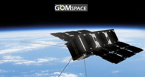
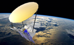
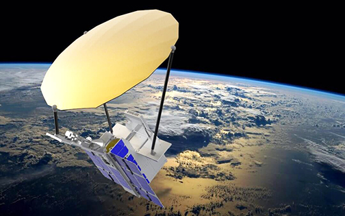
ThrustMe has been selected by GomSpace for the GOMX-5 ESA mission to demonstrate advanced maneuvers for the satellite constellations of tomorrow. While satellites are getting smaller and cheaper, constellations are getting larger and more complex. Thus, advanced propulsion capabilities will be the next competitive differentiator.

Dr. Ane Aanesland, Co-Founder and CEO of ThrustMe, said that for this new space industry to be sustainable, both from an environmental as well as an economical perspective, the company understood that these new satellites will one day need a variety of advanced space propulsion technologies. ThrustMe decided to work on this problem and the firm has brought in revolutionary technological innovations to reply to this industry need.

Niels Buus, CEO of GomSpace, noted that now, when cubesatss have become commoditized, it is time to look at the next step. The GOMX-5 mission is a follow up from the previously successful GOMX-3 and GOMX-4 missions and this time the company wants to test and demonstrate the most promising technologies for miniaturized space propulsion for maneuverability required for the constellations of tomorrow.

Kim Toft Hansen, Project Manager of GOMX-5 at GomSpace, added that the company’s technological solution is truly revolutionary. The firm has brought in breakthrough ideas and coupled it with clever engineering solutions.

Pressurized propellant storage is a significant roadblock for miniaturized propulsion systems; it can be expensive, difficult to manufacture, requires significant qualification testing, not to mention complications and possible safety hazards with transport or filling prior to launch. Already in 2008, the founders of ThrustMe and their former research colleagues at the Ecole Polytechnique/CNRS in France, started looking into using iodine as a propellant replacement for pressurized xenon used in conventional plasma-based propulsion systems.

Dr. Aanesland noted that at that time, it was so exotic that the company had difficulty being taken seriously and not judged as crazy physicists. However, with persistence, theoretical modelling and proof-of-concept experiments showing the feasibility of iodine as an alternative propellant, thruster performance was predicted to be comparable to state-of-the-art systems using xenon. This proved to be an important breakthrough that helped motivate the creation of ThrustMe in early 2017 and the development of a new, completely stand-alone propulsion system. The potential of iodine is now recognized and being explored by a number of companies throughout the world.

Dr. Dmytro Rafalskyi, co-founder and CTO of ThrustMe, added that iodine has some unique properties, but the firm knew that to be able to make this idea into a real product, new thinking had to be applied. Xenon simply cannot be just replaced with iodine and then hope that it would work.

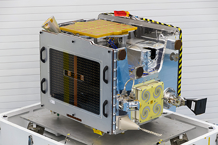
In ThrustMe’s propulsion system, called the NPT30-I2 and to be demonstrated on the upcoming GOMX-5 mission, a heating element causes sublimation of solid iodine into a gas, which is then used to create a plasma in a special discharge chamber. By setting the temperature of the heating element to specific values, the sublimation rate can be precisely controlled and different iodine flow rates obtained. This allows the propulsion system to operate in different modes (such as high-thrust, or high fuel efficiency) at various stages of a cubesat mission, which greatly increases flexibility and opens up further mission options.

ThrustMe’s NPT30 is an intelligent, modular and stand-alone electric propulsion system based on gridded ion thruster technology. The NPT30 operating with xenon propellant is currently commercially available and has been purchased by several clients already. Due to its modular design, new innovations can easily be included. ThrustMe is working on new technologies for both acceleration and propellant management. During the GOMX-5 mission, the NPT30 operating with iodine will be tested to demonstrate the full potential of this system. The NPT30 is expected to enable large orbital transfer maneuvers for the constellations of tomorrow.


Ten Million Euros Grant Heading to NanoAvionics and Consortium Partner

NanoAvionics and consortium partners KSAT (Kongsberg Satellite Services) and Antwerp Space have been awarded 10 million euros funding by the European Commission’s Horizon 2020, ESA’s ARTES and private investors.

The funding is for the first demonstration of the pre-cursor stage of the Global Internet of Things (GIoT) smallsat constellation with one or more IoT/M2M (machine-to-machine) service providers as pilot customers. The consortium will not enter the IoT/M2M business directly. Instead it will offer a GIoT constellation-as-a-service in a B2B setup to existing and emerging IoT/M2M operators.

The GIoT system combines the core strengths of the consortium’s partners in a one-stop-shop offer, giving IoT/M2M service providers the means to be economically viable, globally scalable and competitive. NanoAvionics’ constellation-as-a-service will give service providers a ten-fold reduction in the cost of their global IoT/M2M communications. The GIoT system will also lower the entry barriers for IoT innovators and enable them to devise new ways of M2M communications.

The GIoT system consists of NanoAvionics’ reliable smallsat buses powered by chemical propulsion and enabling constellation synchronization, launch brokerage services, global real-time connectivity enabled by KSAT’s technically mature ground stations network, Antwerp Space’s inter-satellite link via geostationary orbit (GEO) satellites and NanoAvionics’ modular and scalable mission control system.

At the end of next year, the pre-cursor stage, consisting of two to three of NanoAvionics’ interconnected smallsats, will be launched into LEO. The final GIoT constellation will form an interconnected network with 72 satellites and global real-time coverage towards the end of 2023.

The funding for this innovative European project will allow NanoAvionics and partners to develop and launch the pre-cursor stage of the GIoT constellation, taking it from technology readiness to customer on-orbit testing and preparing it for commercialization and scale-up. In particular, the funding will enable NanoAvionics to upgrade its current buses with Antwerp Space’s inter-satellite link for connection with GEO satellites and testing the satellites’ compatibility with KSAT’s network. It will also allow NanoAvionics enhance its modular and scalable mission control system to manage multi-satellite and multi-instrument constellations. The latter will match the various requirements and transceivers operated by different IoT/M2M service providers.

Each nano-satellite, based on NanoAvionic’s preconfigured nano-satellite buses, has up to 10U of payload volume, allowing multiple IoT communications providers to place their M2M transceivers in them. Antwerp Space and KSAT, through their mission control and data distribution system, will connect this nano-satellite constellation with the terrestrial Internet. An Antwerp Space inter-satellite link on each nano-satellite will provide real-time connectivity with traditional GEO satellites. The GIoT constellation will send direct communications from the LEO satellites to KSAT’s global network of ground stations.

The earliest applications by IoT/M2M providers using this new generation of space-based IoT constellation-as-a-service will be in the transport and energy industries. For example, their small sensors on pipelines and oil platforms would be able to send their data to monitoring centres. By using location-based devices providers can let transport companies track aircraft, ships and even individual shipping containers through the most remote regions of the planet. The GIoT will also enable Telco operators to offer cellular network coverage over oceans, a service that so far only exists within developed regions.

Frank Zeppenfeldt, from ESA’s satellite communications group said: the organization is excited to support the GIoT project because we recognize the importance that IoT/M2M and satellite connectivity play for the next level of innovation in almost every industry. ESA’s ARTES program will fund the development of the inter-satellite link from smaller satellites in LEO to commercial GEO communication satellites and will demonstrate low cost data-relay services.

Vytenis J. Buzas, CEO of NanoAvionics, added that the phenomenal support by both the European Commission and European Space Agency shows the importance of this GIoT project and their confidence in our world-class partners and NanoAvionics to deliver it. IoT promises to bring new levels of efficiency to transport, manufacturing and other industries but it needs real-time coverage and lowered cost. While there have been many activities in the IoT/M2M market and a lot of advancement in hardware there is a clear lack of the satellite and ground infrastructure that is required for generating downstream revenue for an IoT market expected to reach $3.21 billion by 2023.

Arild José Jensen, KSAT vice president of global sales, noted the GIoT solution will enable global real-time connectivity for IoT/M2M service providers, and the KSAT contribution will be enabling access to KSATlite, a global ground station network optimized for smallsat constellations, By leveraging the KSATlite network, where the corner stones are automated operations and standardization, GIoT operators will be able to tap into a global, operational and perfectly scalable ground station as-a-service solution. Together with the partners, the company will facilitate continuous connectivity for the GIoT satellites, thereby providing a unique capability which will open up new opportunities for IoT/M2M service providers.

Koen Puimège, anaging director of Antwerp Space.Providing communications to low-cost IoT devices in remote regions has always been difficult and quite expensive,. Today’s cellular networks only provide coverage for densely populated parts of the world’s landmass, which comprises less than 20% of the total Earth surface. Equally, Earth-to-orbit transmissions via traditional satellites require expensive, energy-consuming technology. The market opportunity for this GIoT constellation is to cover the remaining 80% with low cost communication services.


Ursa and HawkEye 360 Join Forces to Develop Geospatial Information Solutions

Ursa now has a strategic partnership with HawkEye 360 to create a new class of radio frequency (RF) data analytics.

The companies will work together to develop new geospatial information solutions that combine synthetic aperture radar (SAR) data with radio frequency (RF) identification and geolocation to monitor activity across air, land and sea.

Through this partnership, Ursa and HawkEye 360 will merge Ursa’s SAR Virtual Constellation Marketplace (VCM) and leading SAR analytic capabilities along with HawkEye 360’s RF data and analytics derived from the company’s cluster of small satellites which provide a new global RF sensing capability.  The real-time integration of these technologies introduces brand new products and services for surveillance on the land and oceans.


An Ursa and HawkEye 360 image of the Ethiopian Dam.

The initial market focus for the two companies will be maritime monitoring, where SAR and RF analytics will combine to provide valuable information in support of real-world applications such as ship traffic monitoring and examining illegal activity that occurs on the ocean. Joint efforts will then expand to land applications where HawkEye 360’s RF sensing and analytics identifies activities of interest which can then cue URSA’s SAR Virtual Constellation to monitor and provide actionable geospatial intelligence. 

Ursa co-founder and CEO, Adam Mahr, noted that partnering with HawkEye 360 is a natural complement to Ursa’s technology and aligns with the firm’s mission to help customers make more informed decisions based on geospatial data. Working in tandem with HawkEye 360 will develop more advanced solutions and introduce to the market new data sets that will provide deeper, more contextual insights into global activities.

HawkEye 360 founder and CTO, Chris DeMay, added that this partnership is a prime example of how HawkEye 360’s powerful analytics provide people, governments and businesses with a greater understanding of global activity.


China Set to Launch New Amateur Satellite with “Sail Ball” Stabilization

Chinese Amateur Satellite Group (CAMSAT) has announced the impending launch of the CAS-7B satellite, also designated as BP-1B, a short-lived spacecraft that will carry an Amateur Radio payload. An unusual feature of the spacecraft is its “sail ball” passive stabilization system. The 1.5-U CubeSat is attached to a 500-millimeter flexible film ball — or sail — that will offer passive “pneumatic resistance” stabilization. CAS-7B is expected to remain in orbit for up to 1 month.

The spacecraft will carry an Amateur Radio transponder and educational mission. CAMSAT is working with Beijing Institute of Technology (BIT), a top aerospace school, which is providing launch support in launch of the satellite. BIT faculty and students are participating in the development and testing of the satellite, and, with CAMSAT’s help, the university has established an Amateur Radio club (call sign BI1LG). CAMSAT said many students are now members, “learning Amateur Radio satellite communication and experience[ing] endless fun.”

The VHF and UHF antennas are quarter-wave monopoles. CAS-7B will transmit a CW telemetry beacon on 435.715 MHz. The V/U FM voice transponder downlink will be 435.690 MHz, and the transponder uplink will be 145.900 MHz (16-kHz passband).

The 3-kilogram satellite will have an apogee of 300 kilometers.

“Because of the orbital apogee and the size and mass of the satellite, the orbital life is expected to be only 1 week, up to a maximum of 1 month, which will also provide an opportunity for hams to track and monitor satellite entering the atmosphere,” CAMSAT said in announcing the new satellite, scheduled for launch in late June.

“The launch will use a new launch vehicle from a small commercial rocket company,” CAMSAT explained. “This is the first launch of this launch vehicle, and there is a large possibility of failure; if the launch fails, we will have another launch later this year.”

QRZ.com Source:ARRL

Purdue’s Space Trash Collection Plan … Sail to Smoother and Safer Reentry

Purdue University is celebrating its 150th anniversary. As part of the festivities a team in the School of Aeronautics and Astronautics has initiated a plan to deorbit old satellites and spacecraft. The following is an article released from their news service.


David Spencer, a Purdue University renowned space exploration expert, is turning to sailing technology to help provide more timely reentry for space objects. (Purdue University photo/Rebecca Wilcox)

More than 22,000 objects floating in space are currently being tracked by the U.S. Air Force. That number is expected to double within five years, due in large part to increased global demand for satellite internet services and private companies launching of more space objects to meet that demand.

So, what happens to those floating satellites and other space objects when they have outlived their usefulness? They need to deorbit and reenter Earth’s atmosphere. Though the chances are extremely low of the space objects crashing to Earth and causing injury or damage, there is still a slight risk of that happening.

Now, a Purdue University renowned space exploration expert is trying to make sure those objects have a smoother and safer time upon reentry. He is turning to sailing technology to help do it.

David Spencer, a Purdue alumnus and associate professor in Purdue’s School of Aeronautics and Astronautics, is leading a team to develop a sail system to deorbit old satellites and spacecraft.

“We are developing drag sail technology,” said Spencer, who worked for 17 years at NASA before joining the Purdue faculty. “These sails would launch attached to the satellites or launch vehicle upper stages and then deploy at the end of the mission to slow down the objects, remove some energy and help them to deorbit safely.”

Spencer’s team is working to put their technology into space in 2020 attached to small satellites called CubeSats. They are currently testing a prototype of the system as they work toward that goal.

“Packaging the sail material and deployment booms into a half-liter volume is the primary challenge that we have addressed.” Spencer said. “We are working toward launch in 2020, as we continue to position Purdue as a leader in space technology.”

His team’s work aligns with Purdue’s Giant Leaps celebration, celebrating the university’s global advancements in space exploration as part of Purdue’s 150th anniversary. This is one of the four themes of the yearlong celebration’s Ideas Festival, designed to showcase Purdue as an intellectual center solving real-world issues.

The Purdue Research Foundation Office of Technology Commercialization has filed a provisional patent on the innovation, and the office has signed a licensing option for the drag sail technology with Spencer’s company, Vestigo Aerospace LLC.


Clyde Space Delivers NSLSat-1 to Vostochny Cosmodrome for Launch

ÅAC Microtec‘s subsidiary, Clyde Space, has delivered the company’s first 6U cubesat, NSLSat-1, to the launch provider.

This groundbreaking communications satellite is part of a space-as-a-service contract under which AAC Clyde Space designs, manufactures, launches, and operates the satellite on behalf of NSLComm. The mission is set to revolutionize the space communications network with the introduction of an innovative, high-performance, deployable antenna and sub-reflector system. The satellite is intended to be the first in a future constellation of about 80 satellites.


Artistic rendition of the NSLSat-1 smallsat.

NSLSat-1 is due to be launched June 2019 on a Soyuz launch vehicle from Vostochny Cosmodrome, in far eastern Russia. This delivery is a key milestone for the company and the NSLSat-1 mission represents a full end-to-end mission service package, from spacecraft design to data supply to NSLComm.

This advanced 6U cubesat will demonstrate highly disruptive technology providing Ka-band communications from LEO. It is equipped with an innovative parabolic antenna which will be deployed once the satellite is on orbit, enabling a wide array of new applications and affordable space based, high-speed data transfer with expected data rates of up to 3 Gbps.

The satellite’s antenna and sub-reflector payload has in-built smart technology capable of changing the ground pattern of the antenna beam depending on the area of interest at the time. This versatility of operation enables the concentration of the data to specific locations on the ground, achieving what are likely to be record breaking data rates.

NSLComm develops satellite technology that enables high-speed data transfer for government, commercial, and private applications. The long-term vision for NSLComm is to provide a worldwide communications network via an orbiting constellation of about 80 spacecraft providing global coverage data and media applications.

Dr. Raz Itzhaki, CEO of NSLComm, said that NSLSat-1 was conceived four years ago. It is going to provide an unprecedented throughput of above 1Gbps which is 100 times more throughput than similar satellites capabilities. The successful cooperation with Clyde Space is a stepping stone to an envisioned communication constellation.

Craig Clark, Chief Strategy Officer at Clyde Space, added that this mission is pushing the boundaries of data rate capability from very small satellites, proving a performance level that will make traditional telecom companies take notice.

SSTL Image Reveals De-Orbit Drag Sail On-Board TechDemoSat-1 Successfully Deployed

Surrey Satellite Technology Ltd. (SSTL) has released an image showing the successful deployment of the de-orbit drag sail on-board TechDemoSat-1.

The deployment of the Icarus-1 drag sail, which was supplied by Cranfield University, marks the end of mission operations for SSTL’s TechDemoSat-1 small satellite which was launched into a 635 km. LEO in 2014. 


Image acquired by the inspection camera on board TechDemoSat-1 showing the Icarus-1 sail deployed with a view of Earth beyond. The equipment top left is the satellite’s Antenna Pointing Mechanism.

Photo is courtesy of SSTL.

TechDemoSat-1, a 150 kg. on-orbit technology demonstration smallsat mission, validated eight innovative UK spacecraft instruments and software payloads and also acquired ocean wind speed datasets using GNSS reflectometry. The deployed sail measures approximately 6.7 m2 and is designed to significantly increase the spacecraft’s rate of orbital decay, in compliance with current Space Debris Mitigation best practice and guidelines. 

The Icarus-1 drag sail consists of a thin aluminium frame fitted around one of the external panels of the spacecraft in which four trapezoidal Kapton sails and booms are stowed and restrained by a cord.  Deployment is achieved by activating cord-cutter actuators, allowing the stored energy in the spring hinges to unfold the booms and the sail. 


The TechDemoSat-1 satellite during assembly at SSTL in 2013.

Photo is courtesy of the company.

The inspection camera on-board TechDemoSat-1 was manufactured by SSTL’s optics experts from COTS (Commercial-Off-The-Shelf) technologies and combines a colour CMOS camera with a high performance machine vision lens delivering 1280 x 1024 resolution imagery and a field of view of 65 x 54 degrees. The camera previously captured footage moments after separation from the Fregat upper stage of the Soyuz-2 launcher, as the satellite began its first orbit in space. 

SSTL is the satellite platform manufacturer and spacecraft operator for the RemoveDEBRIS mission, and the supplier of the Target satellite for ASTROSCALE’s ELSA-d end-of-life spacecraft retrieval and disposal technology demonstration mission.

TechDemoSat-1 was part-funded by Innovate UK and was jointly operated by SSTL in Guildford and by the Satellite Applications Catapult in Harwell. The spacecraft carried eight separate payloads from UK academia and industry, providing valuable in-orbit validation for new technologies:

  • MuREM, a flexible miniature radiation and effects monitor from Surrey Space Centre
  • ChaPS, a prototype compact instrument to detect electrons and ions from the Mullard Space Science Laboratory
  • HMRM, a lightweight, ultra-compact radiation monitor designed to measure total radiation dose, particle flux rate and identify electrons, protons and ions from Rutherford Appleton Laboratory and Imperial College
  • LUCID, a device to measure characterization of the energy, type, intensity and directionality of high energy particles from the Langton Star Centre
  • Compact Modular Sounder system, a modular infrared remote sensing radiometer unit from Oxford University’s Planetary Group and Rutherford Appleton Laboratory
  • De-orbit sail (Icarus-1 mentioned above) from Cranfield University
  • Cubesat ADCS, a 3-axes attitude determination and control subsystem from SSBV
  • Sea State Payload, a device using an enhanced GPS receiver from SSTL and components from a Synthetic Aperture Radar from Airbus Defence and Space to monitor reflected signals to determine ocean roughness.


Sarah Parker, Managing Director of SSTL, said it is fantastic to see an image of TechDemoSat’s deployed drag sail captured by the onboard inspection camera.  This on-orbit image of a deployed drag sail on one of the company’s satellites is a first for SSTL and is a fitting culmination of mission operations for this highly innovative small satellite.

Stephen Hobbs, Head of Cranfield University’s Space Group, commented that Cranfield is delighted to see the Icarus de-orbit technology demonstrated successfully on-orbit once again.  With the Icarus sails now deployed on both TechDemoSat-1 and Carbonite-1, SSTL and Cranfield have demonstrated clear leadership in this technology.  All hope to see many more satellites following TechDemoSat-1’s example to keep space clear of debris. It’s been great to work with SSTL on this mission.

Do You Know Where Your Reindeer Are? Globalstar and PrismaQuality Finland Know…

Globalstar Europe Satellite Services Ltd., a wholly owned subsidiary of Globalstar, Inc. (NYSE MKT: GSAT) is revealing that farmers have deployed a new Globalstar IoT technology solution to track and protect thousands of reindeer in the north of Finland and Sweden.

Since trialing its ReindeerApp and collar less than a year ago, newly-signed Globalstar Value Added Reseller PrismaQuality Finland has seen rapid uptake among reindeer herd owners whose livestock roam fence-free in Scandinavia’s vast northern hinterland.

ReindeerApp enables farmers to keep track of their herds, and helps mitigate losses from predators such as wolves and bears. The user interface which PrismaQualityFinland developed notifies herders when a deer is no longer moving, and thanks to Globalstar’s extensive satellite coverage and accuracy, the farmer knows exactly where to go to check on the animals.


Globalstar’s SmartOne C product.

The SmartOne C’s long battery power means farmers need only change the collars’ batteries during the annual round-up in June, when herds get health checks and new-born fawns are marked to identify who owns them.

Reindeer husbandry has been carried out in Lapland, Northern Finland, and across the northern Scandinavian region by indigenous Sami communities for over a millennium. Descendants of these original reindeer farmers continue that tradition today, however modern farming principles are being increasingly adopted. There is huge economic value from the 200,000 reindeer in Finland including the sale of meat and products made from skin and leather, horn and bone.

Reindeer tracking systems based on GSM have been trialed in the past, but inadequate reliability in remote regions, higher price and poor battery life made these systems ineffective.

Beyond Finland, ReindeerApp is also now being used in Sweden, where there are 250,000 reindeer. Deployments are also expected in Norway, as well as in Canada to track caribou, and to manage other deer species in Nepal and Mongolia.

Petter Kroneld, Product Development Manager of PrismaQuality Finland, said that when farmers asked the company to develop a tracking collar for their reindeer, we knew immediately that satellite connectivity would be essential to deliver the reach that was needed. The company designed the collar around SmartOne C due to its satellite coverage, superior battery life, small size and low cost.

Robert Clarke, Regional Sales Manager at Globalstar, added that satellite IoT is transforming industries of all kinds, and applications are limited only by human imagination. The company’s state-of-the-art IoT technology, combined with the firm’s worldwide fleet of satellites in LEO, is now helping reindeer farmers preserve their livelihoods and their traditional way of life.

SpaceX Starlink Could Soon Initiate Services Over North America

Elon Musk’s satellite-based broadband constellation could start offering services over North America after just six batches of satellites have been launched, this according to a report at Advanced Television‘s infosite.

The first batch of 60 satellites were launched successfully last week on May 23rd. SpaceX, where Starlink is a subsidiary company, said it will launch between two and six dedicated extra Starlink launches by the end of this year and a potential 600+ satellites on-orbit by the end of 2020.


Artistic rendition of a SpaceX Starlink satellite.

If SpaceX can launch those extra rockets, and each successfully carries 60 satellites, then an optimistic forecast could see consumers and businesses tap into the system this coming winter. Musk has said that in time the Starlink system could bring in £30 to $50 billion annually.

However, there’s a problem, and it concerns the ground-based antenna receivers which are currently horribly expensive and well out of the pocket of the average consumer. Each satellite transmits four phased array antennas to the ground. That’s the good news. The challenge is that the satellites are traveling at a terrific speed across the sky, which is why thousands of them are needed to complete the constellation. One satellite passing overhead will be replaced by another before the first craft drops beyond the horizon.

A rival to Starlink, Kymeta Corp, supplies similar LEO receivers at a cost of about $30,000 each.  An Iridium satellite terminal (for its Go! 9560 product) costs about $700. Elon Musk has said that each Starlink receiver will be “medium pizza-box sized,” but his team’s aim now will be to see those costs trimmed to just a few hundred dollars initially. Indeed, that’s the target Musk has set. Each terminal could cost about $200, and at that price the system could be appealing to many tens of thousands of potential users unable to access adequate broadband signals.

Spacecraft’s MITRE Antenna Gains Faster Satellite Data for Government Communications and ISR Missions

Analytical Space Inc. (ASI) is launching a technology demonstration spacecraft intended to pave the way for users on the ground to gain faster access to satellite data. The spacecraft features a patented MITRE antenna that could help enable that application, as well as government missions including tactical communications and intelligence, surveillance, and reconnaissance.

ASI’s 3U CubeSat, dubbed Meshbed, will perform on-orbit testing of MITRE’s Frequency-scaled Ultra-wide Spectrum Element (FUSE) antenna. The initial on-orbit demonstration will be dedicated to data collection to explore U.S. government applications for the MITRE technology. Meshbed will then shift its focus to testing ASI’s data relay capability, expanding on the testing achieved by its tech demo predecessor, Radix, which deployed from the International Space Station in 2018.

MITRE developed the FUSE antenna in collaboration with the U.S. Naval Research Laboratory as part of an effort to conserve topside space on ships. This new class of antennas has a novel electromechanical interface that eliminates the need for radio frequency connectors, reducing cost, weight and size. The company recently received three patents for FUSE, which has been successfully demoed in the field, and some of the technology has been transitioned as a multi-function system.1R&D Magazine recently honored the MITRE team with an R&D 100 award for the FUSE antenna.

A new variation of the antenna built entirely of metal was further developed at MITRE. The latest breed (patent-pending) is scalable for CubeSat missions, maintains the same features from the original invention, and is produced at a more compelling price-point because of the use of metal additive manufacturing (AM) technologies. By solving the problem of fitting a wideband antenna onto a CubeSat and demonstrating that it can operate in the harsh space environment, FUSE will accelerate the development of high-performance and multi-function systems, with a wide range of applications that includes military use and commercial satellite communications.

Incorporating the wide frequency range of FUSE on Meshbed will enhance the satellite’s capacity to communicate with other satellites, a critical component of ASI’s data relay service. Together with the results from Radix, the testing performed on Meshbed will inform the development of future capabilities in ASI’s global network. The network will dramatically expand the downlink capacity of Earth observation satellites, which currently face severe constraints relaying data.

MITRE and ASI began working together through the MassChallenge startup accelerator as part of MITRE’s Innovation Bridge activities, an initiative to connect startups with government agencies.

“This partnership demonstrates our agility in collaborating with commercial and not-for-profit partners to develop innovative solutions,” says Dan Nevius, CEO of ASI. “We’re looking forward to working with MITRE to continue developing and testing innovative solutions to meet government needs while fostering growth in the commercial sector.”

“This is a great example of MITRE’s ability to take technology developed to solve a difficult challenge for one of our government sponsors and accelerate technology development via government/commercial-partnered collaborative environment at an affordable cost,” said Jay Schnitzer, MITRE’s chief technology officer. “Working together with government and industry, we can apply our deep expertise to solve potential barriers to the effective use of small space systems.”

References:

[1] U.S. Patents# 9,991,605, and 10,056,699 and 10,141,638.